Most of Girraween's rain falls between November and March, with an average rainfall of 850mm per year. But every now and then, Mother Nature alters the norm and trickling streams or still pools become raging torrents.
Not all of Girraween's floods have been recorded, but it is known that Bald Rock Creek experienced major flooding in 1969, 1971, 1974 and 1976. The biggest flood for the Girraween area was in 1971. It lasted for longer than a week.
More recently, Bald Rock Creek has had flash floods in 1995, 2000 and 2008.
As with much of Queensland, Girraween suffered severe flooding in January 2011. Floodwaters not only washed out minor and major roads, but most of Girraween's walking tracks and fire trails. The park was closed for six weeks while repairs were made.
|
Next...
Wild Winds.
|
|
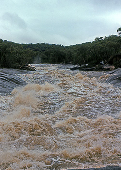
Bald Rock Creek in the 1976 flood.
|
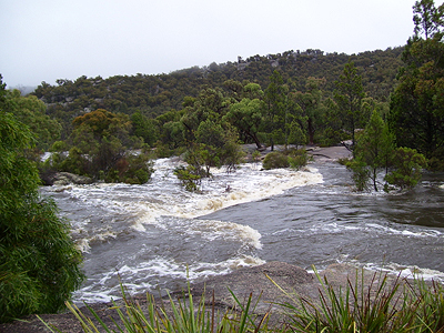
Bald Rock Creek in the 2008 flood.
|