|
|
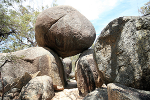
Granite Arch.
|
This section was written with assistance from Warwick Willmott - Geological Society of Australia, Queensland Division.
Warwick has written a series of books about the geology of Queensland. If you are interested in his books, you can find them on the Geological Society of Australia, Queensland Division's website.
|
Girraween National Park is situated on the northern extremity of the New England Tableland. Its remarkable scenery is one of the best examples of a granite landscape in Australia and results from many millions of years of geological activity and weathering.
Granite Foundations
The granite at Girraween is just one small section of a great mass of rock - the Stanthorpe Granite - which underlies most of the Granite Belt of Queensland. This is itself only part of an even larger complex of granitic rocks of different ages - the New England Batholith - which stretches from just south of Warwick (in Queensland) down to Armidale (in New South Wales); a distance of just over 250 kilometres (160 miles).
More...
The Sculptured Landscape
There are two processes in action which shape the landscape of Girraween. These are weathering and erosion. Wind, water, ice and plants are the tools of Nature that sculpt the granite, taking millions of years to create the wonders we see today.
More...
|
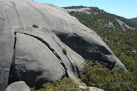
The sculpted slopes of the Second Pyramid.
|