Maps
Click on the thumbnails to go to the larger maps.
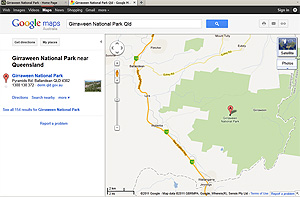
Google Map
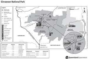
Government Park Map - Printable A4 size
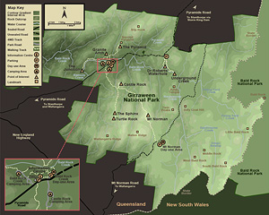
Park Map
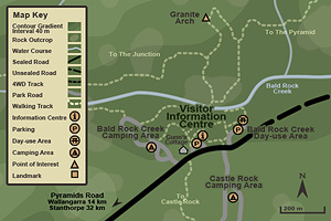
Map showing the Visitor Information Centre
More About:
The Visitor Information Centre
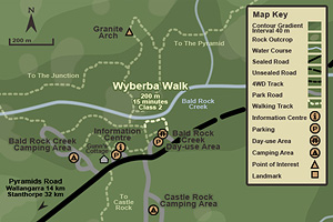
Wyberba Walk
More About:
The Wyberba Walk
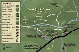
Map of the Bald Rock Creek Circuit
More About:
The Bald Rock Creek Circuit
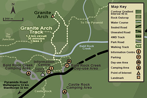
Granite Arch Track
More About:
The Granite Arch Track
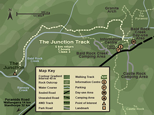
The Junction Track
More About:
The Junction Track
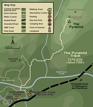
The Pyramid Track
More About:
The Pyramid Track
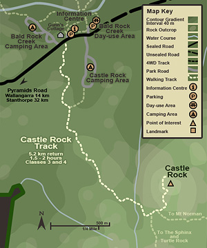
Castle Rock Track
More About:
The Castle Rock Track
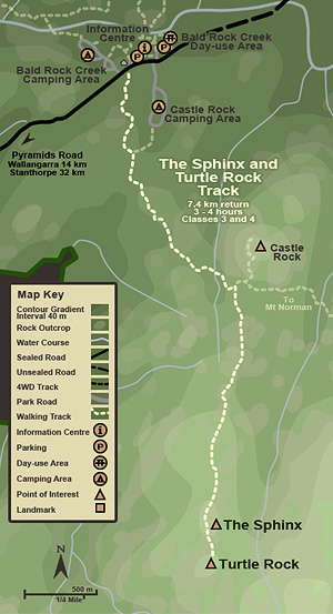
The Sphinx and Turtle Rock Track
More About:
The Sphinx and Turtle Rock Track
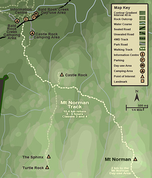
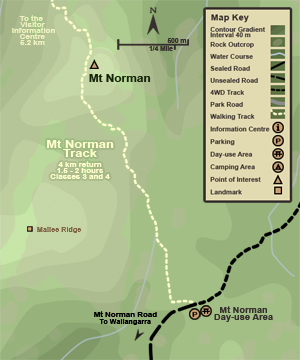
Mt Norman Track - North End
More About:
Mt Norman Track - North End
Mt Norman Track - South End
More About:
Mt Norman Track - South End
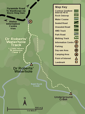
Dr Roberts' Waterhole Track
More About:
Dr Roberts' Waterhole Track
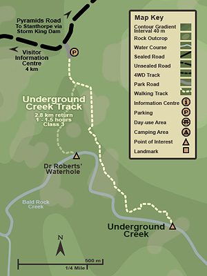
Underground Creek Track
More About:
The Underground Creek Track
© Vanessa and Chris Ryan, 2009 |
Copyright Details and Disclaimer
Last updated: 29th October 2013