Home
What's New?
Search
Maps
Gallery
History
Plants
Algae,Fungi and Lichen
Animals
Geology
Tracks
Picnics
Camping
Visitors Information Centre
Asteroid
Song
Stamps
Downloads
References
Thanks to...
About Us
Contact Us
To Official Government Website
Flannel Flower
 

The Walking Tracks


Girraween National Park has a number of excellent walking tracks, about 17km in total. Their difficulties range from Class 2 to 4 (Australian Standards). For more detailed information about the specific tracks, we suggest you visit the Official Girraween Website.

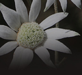
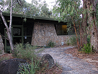
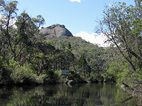
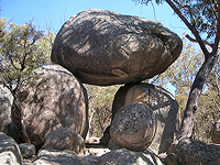
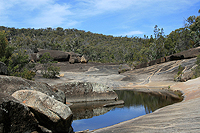
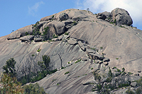
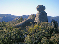
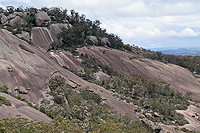
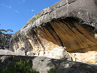
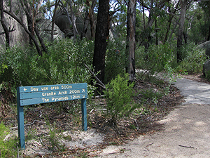
Our pages here contain photographs we've taken along the different tracks. We will add to them as we do more of the walks. We may also do the same walk again at a different time of year, so that's why we've linked the photos (where possible) by the date.

The walking tracks of Girraween are well signed.


Park Map             For a printable map, see the Official Girraween Website map.


The Visitor Information Centre

The rangers at the centre will be able to answer any questions you may have about the walking tracks.

Map

Visitor Information Centre


Wyberba Walk

200 m
15 minutes
Class 2

Map

A view of The Pyramid.


Bald Rock Creek Circuit

2 km circuit
1 hour from Bald Rock Creek day-use area
Class 3

Map

The Bald Rock Creek Circuit.


Granite Arch

1.4 km circuit
30 minutes from Bald Rock Creek day-use area
Class 3

Map

Granite Arch.


The Junction

5 km return
2 hours from Bald Rock Creek day-use area
Class 3
or
3.7 km return
1.5 - 2 hours from Bald Rock Creek camping area
Class 3


Map

The Junction.


The Pyramid

3.4 km return
1.5 - 2 hours from Bald Rock Creek day-use area
Classes 3 and 4

Map

The Pyramid.


Castle Rock

5.2 km return
1.5 - 2 hours from the Visitor Information Centre
Classes 3 and 4

Map

Castle Rock.


The Sphinx and Turtle Rock

7.4 km return
3 - 4 hours from the Visitor Information Centre
Classes 3 and 4

Map

The Sphinx.


Mt Norman

10.4 km return
4 - 5 hours from the Visitor Information Centre
Classes 3 and 4
or
4 km return
1.5 - 2 hours from Mt Norman day-use area
Classes 3 and 4


Map 1
Map 2

Mt Norman.


Dr Roberts' Waterhole

1.2 km return
30 minutes from Dr Roberts' carpark
Class 2

Map

Dr Roberts' Waterhole.


Underground Creek

2.8 km return
1 - 1.5 hours from Dr Roberts' carpark
Class 3

Map

Underground Creek.


© Vanessa and Chris Ryan, 2009 | Copyright Details and Disclaimer
Last updated: 29th October 2013