At 1,267 metres, Mt Norman is the highest point in Girraween National Park. The track to Mt Norman is accessed from the Castle Rock track and from the Mt Norman Day-use Area on Mt Norman Road. It passes through woodland, forest and shrubland on wide rock pavements and gently climbs to the rocky base of the mountain. Here the track gets steeper as it traverses the open rock slopes. A point of interest along the way is a granite cairn which marks the original trigonometrical survey station erected on the mountain. From the walking track you can also see the Eye of the Needle — two balancing rocks — on Mt Norman's northern face.
|
|
|
The Mt Norman track skirts the western side of the summit rocks before descending the steep slopes again. There is no track to the actual summit of the mountain. To reach the summit, rock climbing experience is necessary. Please do not attempt to rock climb alone.
It is advised that you carry water, as hikers cannot rely on the seasonal creeks found along the way.
|
10.4 km return
4 - 5 hours from the Visitor Information Centre
Classes 3 and 4 |
or |
4 km return
2 hours from Mt Norman day-use area
Classes 3 and 4 |
| Map 1 |
A map of the northern part of the walking track. |
| Map 2 |
A map of the southern part of the walking track. |
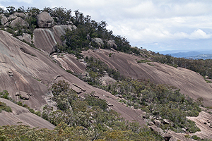
| Views of the Mountain |
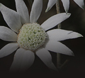
Mt Norman is a granite dome. While its peak is bare rock, the lower slopes are covered with pleasant bushland.
[19 photos] |
| Views from the Top |
Mt Norman is the tallest point in Girraween National Park. The view from here is spectacular, but remember, you need to be experienced in rock climbing to be able to get to the very top. Please do not climb alone.
[18 photos] |
| Eye of the Needle |
The Eye of the Needle is a geological feature on the north eastern side of Mt Norman. Find out about how this amazing natural feature may have formed, along with a gallery of photos.
[9 photos] |
| June, 2012 - Pt 1 |
This first sequence of photographs was taken along the northern end of the Mt Norman track. It starts where the Mt Norman track splits from the Castle Rock track and ends at the beginning of the climb up the northern side of Mt Norman.
[184 photos] |
| June, 2012 - Pt 2 |
This second sequence of photographs begins where the first sequence (above) ended. It finishes where the track starts to skirt along the top of Mt Norman's western slopes. It was a clear Winter day and the views were spectacular.
[114 photos] |
| September, 2012 |
This series of photographs begins on the southern slopes of Mt Norman [where the May 2009 sequence ends] and covers the section of track that goes along the mountain's western slopes. The series ends on the northen side of the mountain [where the June 2012 sequences finish].
[188 photos] |
| May, 2009 |
This is a series of photographs taken along the southern end of the Mt Norman track – going from the Mt Norman Day-use Area to the point on Mt Norman where the track begins to traverse its western slopes.
[176 photos] |