|
|
On Tuesday 26th June 1827, explorer Allan Cunningham was the first European person to enter the area of present day Girraween National Park. Cunningham found his way to a high spot in a north-eastern section of Girraween, possibly near Quart Pot Creek, where he was confronted by a daunting vista of what seemed to be an endless barrier of ridges.
‘Cunningham recorded: “Large detached masses of granite of every shape towering above each other, and in many instances standing in almost tottering positions, constituted a barrier before us.” His noon recording of that day (28o 52' 9") places him between Mt Norman and Bald Rock, so his description is most fitting. Cunningham then changed direction, having determined to follow a running stream that flowed north. Though they had travelled eleven miles that day, their camp was within two miles of the camp site of the previous night.’
The frustration at having made so little progress through the rugged landscape took its toll. Cunningham and his group of six servants and eleven horses decided to travel northwards into gentler regions.
|
|
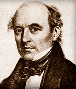
Allan Cunningham.
|
|
Rapid settlement of the Darling Downs and Granite Belt followed pioneer Patrick Leslie's 1840 expedition, but the relatively inhospitable Girraween area was avoided until 1843, when Robert Ramsay Mackenzie was the first squatter to legally occupy Girraween land.
However, hardly a year later in 1844, Mackenzie went bankrupt and his manager, Henry Hayter Nicol, leased the station - then known as ‘Nicol's Run’. Nicol's Run ran through the main valley where today's Bald Rock Creek day-use and camping areas are located, and eastwards beyond the Pyramids. Interestingly, back then, the roads didn't run east/west like today's Pyramids Road. The road (or run) went north/south via Castle Rock and then west to Bald Mountain.
The prominent landscape artist, Conrad Martens, visited the area on his historic journey from Brisbane to Sydney. Along the way, he stayed with squatters and pastoralists, drawing their houses and properties - hoping for commissions. One such drawing is "Terrawambella on Nicol's run, New England, March 19th 1852". From the title of the sketch, it is possible that Terrawambella was the original Aboriginal name for The Pyramids. Martens noted on his drawing an estimated height for The Pyramids of 500-600 ft. Their actual height is around 400 ft, or 120 m.
|
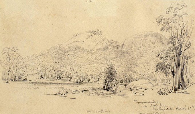
"Terrawambella on Nicol's run, New England, March 19th 1852" by Conrad Martens.
|
|
Parts of three other runs also lay within the Girraween area - the Tenterfield, Ballandean and Maryland/Folkestone Runs. Run boundaries were decided by consensus between neighbouring squatters, so it is difficult today to determine exactly where they were, but it is believed that these three joined at a point east of Mt Norman.
In 1868, a government scheme (The Crown Lands Act of 1868) allowed anyone the right to select from 40 to 640 acres of any squatter's holding - providing the selector fulfilled certain cultivation, residence and improvement conditions.
There followed another period of settlement, greatly boosted in 1872 by the discovery of tin on the Granite Belt. Prospectors did look for tin in Girraween, but found none. Once again, Girraween was overlooked for a time and it was not until 1898 that the first selectors took up their blocks of land in that area to call their home.
Next...
The Wyberba Farms.
|
References
|
| 1. |
"They Came to a Plateau (The Stanthorpe Saga)"; by Jean Harslett and Mervyn Royle; Samuel Lee & Co. Pty Ltd, Stanthorpe; 1972; page 6. |
|